30 Acres of Marsh on Bayou la Loutre
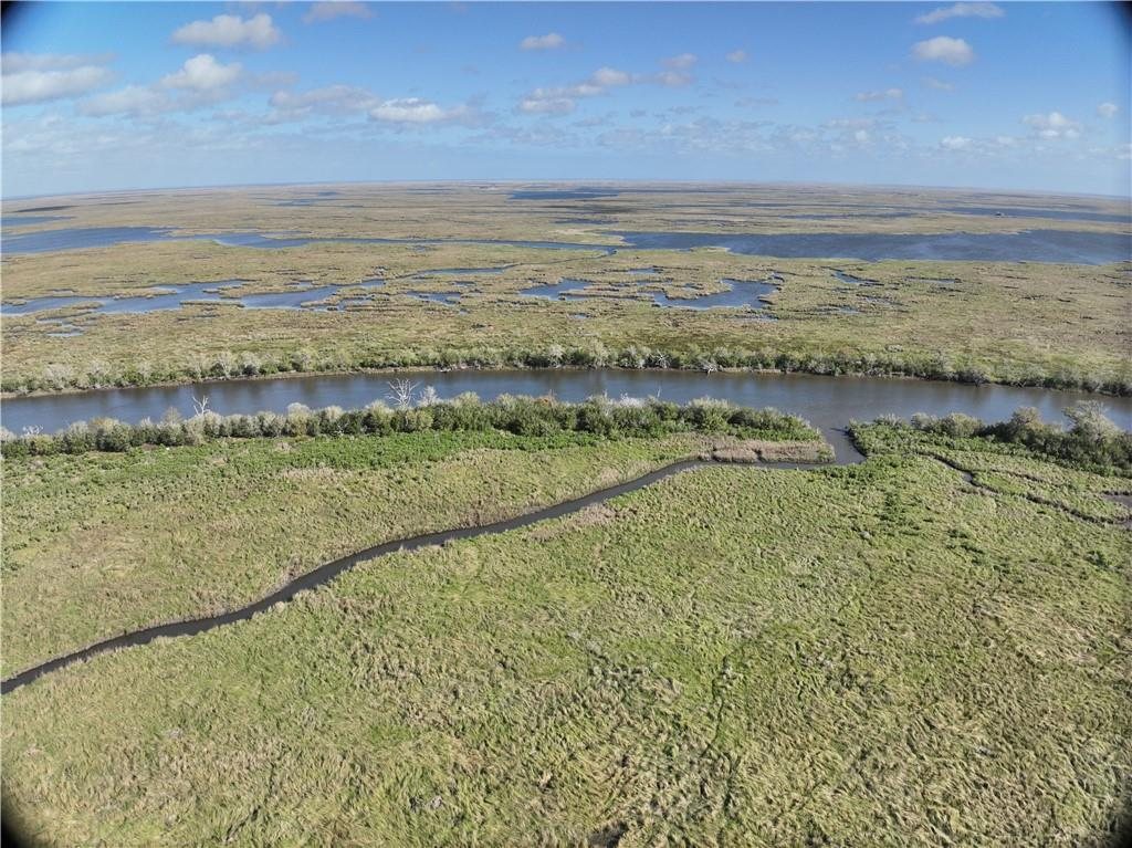
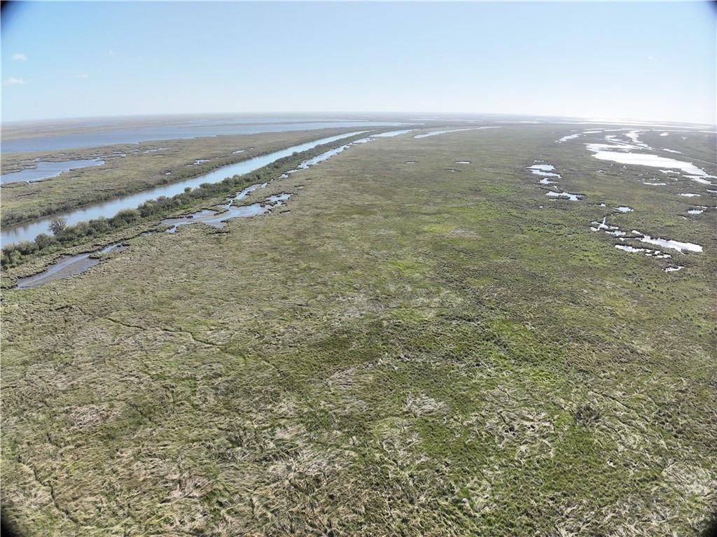
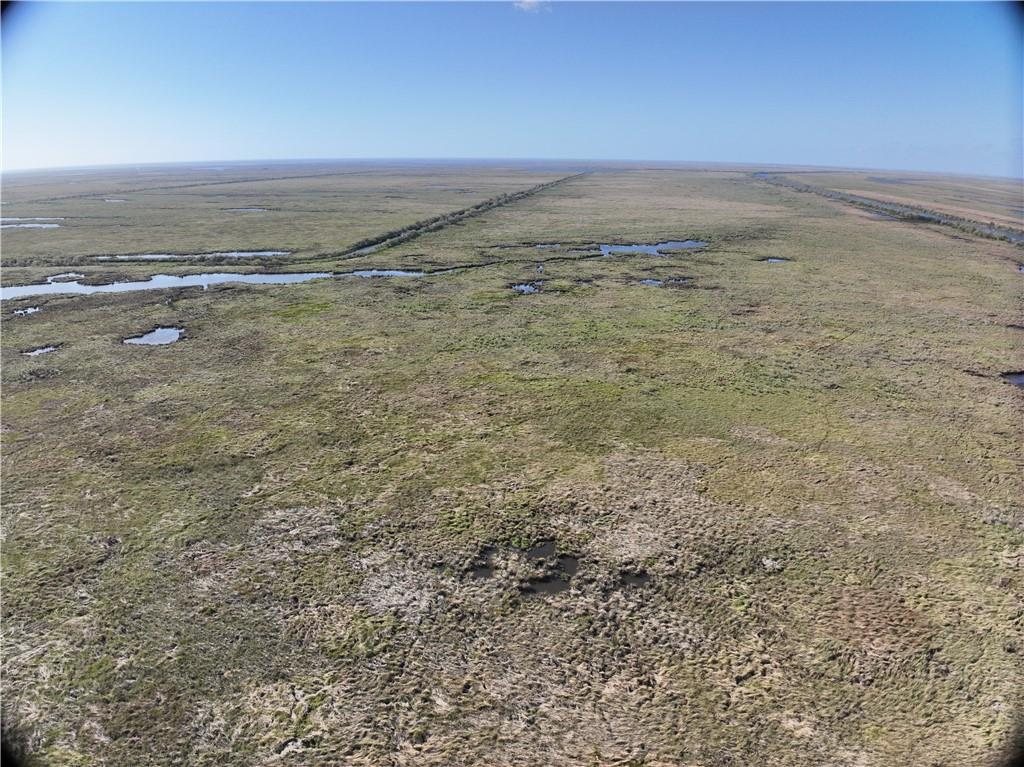
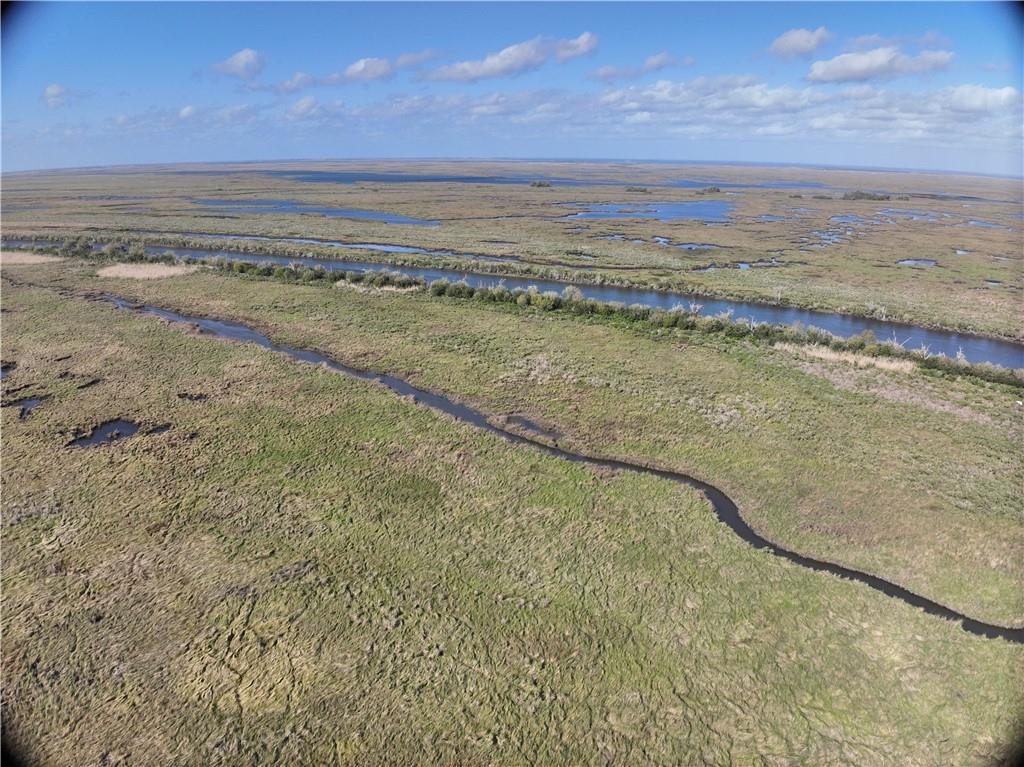
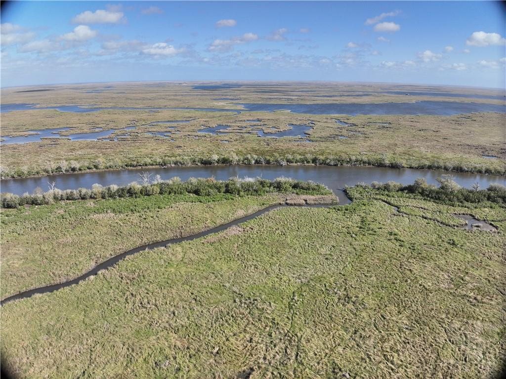
Thirty acres of Louisiana marsh on Bayou la Loutre, in St. Bernard Parish. At $667 an acre it carries the highest per-acre price of the four tracts, which is normal for the smaller pieces in a group like this.
These are water access only parcels. There is no road to them. Reaching the property means going by boat, and that should shape how you think about the purchase.
The setting is the draw. Thousands of acres of wetland surround these tracts, supporting redfish and speckled trout fishing, duck hunting, crabbing and shrimping, with Lake Borgne and the Gulf within reach and the Biloxi Marsh close by.
Multiple parcels are available here, so a single tract or several combined are both possible. Call and we will work out what fits.
A location study by McKay & Associates, a Louisiana engineering and land surveying firm, places these holdings from the legal descriptions and USGS quadrangle maps. It is expressly not a boundary survey and no field work was done, so treat the boundaries as indicative and commission your own survey if that matters to you.
The minerals go with the land. The 2022 title research found no reservation of minerals anywhere in the chain and found every old oil and gas lease expired for lack of production; the parish conveyance records from April 2022 to October 2026 hold no mineral lease on these tracts; and the State's SONRIS records show no well permitted in St. Bernard Parish since April 2022 and no production unit on these sections. The State's restoration servitude over these tracts leaves the minerals expressly unaffected. What you buy is the minerals as well as the surface, unleased, with no mineral income today and no attorney's opinion on mineral title. The recorded deeds, the title research and the surveyor's location study are linked below.
What stands out
- 30 acres in St. Bernard Parish
- $667 per acre
- On Bayou la Loutre
- MLS 2566392
- Minerals convey with the land; unleased, no well
- Part of a group of four tracts
- Water access only, reached by boat
- Near the Biloxi Marsh, Lake Borgne and the Gulf
- Redfish and speckled trout fishing, duck hunting, crabbing, shrimping
Where it is
16 mi from St Bernard · Tract outlines from the engineer's location study, not a boundary survey
The details
| Parish | St. Bernard Parish, Louisiana |
|---|---|
| MLS number | 2566392 |
| Acreage | 30.0 acres |
| Ownership interest | Full ownership, confirmed against the parish assessment |
| Legal description | E/2 SW/4 SW/4 of Section 15 lying south of Bayou La Loutre (20 acres) and SW/4 SW/4 SW/4 of Section 15 (10 acres), T14S-R16E |
| Price per acre | $667 |
| Land type | Coastal marsh / swampland |
| Survey | Location study only, McKay & Associates, March 2026; maps the holding at about 458 acres |
| Mineral, gas & water rights | Convey with the interest offered. No mineral reservation was found in the chain of title (abstractor's title research to 26 April 2022, and the parish conveyance index from then to 28 October 2026). Not leased; no well; no production unit on the tract. The State owns the beds of navigable waters and the oyster beds. No mineral title opinion has been obtained. |
Deeds, maps and title records
The recorded instruments, the surveyor's location study and the title research behind this listing. Each opens as a PDF; the State's own records open on the Louisiana SONRIS site.
- Quitclaim, The Nature Conservancy to PMO & Company LLCRecorded 12 July 2024, St. Bernard Parish File 665814, Book 1263, Page 240. All seven tracts. The minerals clause is an exception from warranty, not a reservation: nothing is held back. PDF · 455 KB · 12 pages
- Temporary easement, servitude and right-of-way to the Coastal Protection and Restoration Authority, project PO-0178, Tract 18Granted by The Nature Conservancy 27 April 2023, recorded 31 May 2024, File 664963, Book 1261, Page 361. Twenty years from 16 April 2024. The minerals are expressly unaffected. PDF · 4.6 MB · 11 pages
- 2024 closing file: assessor listings, the World Wildlife Fund donation deed and the 1976 judgmentThe seven parcels as assessed in 2024 with their tax bill numbers and the fractions held; the Donation Deed from World Wildlife Fund, Inc. to The Nature Conservancy of 28 March 2023, recorded 12 May 2023, File 658122, Book 1247, Page 343; and the 1976 judgment in the Succession of Mrs. Aimee E. Gill. PDF · 5.8 MB · 18 pages
- Acceptance of Donation by The Nature Conservancy, with the title report's caption, maps and document indexSigned 27 April 2023. Followed by the caption, tract maps and document index of the Limited Title Research Report of Seale & Ross, PLC and Ric Bajon & Associates, L.L.C. PDF · 3.3 MB · 19 pages
- Limited Title Research Report, 2022 (excerpt)Thirty-four pages of the abstractor's report on the chain of title through 26 April 2022: the conveyances found, the undivided interests, the expired oil and gas leases and the clouds on the surface title. An excerpt; the lease pages and the 1938 Munson deed are not in it. PDF · 8.9 MB · 34 pages
- Location study, McKay & Associates, job 26-026, revised 22 April 2026Maps the seven tracts from the legal descriptions and USGS quadrangles, with aerials. Not a boundary survey; no field work was done. PDF · 4.5 MB · 12 pages
- Louisiana SONRIS data portalThe State's public record of mineral leases, wells and units, searchable by parish, township and range or by State Lease number. The checks described on this page were made here. Louisiana DENR · opens in a new tab
Before you buy this parcel
- The recorded deed conveys by quitclaim without warranty and is made subject to exceptions including title to all oil, gas and other minerals (not examined), title to any portion considered federal or state waterbottoms, State ownership of oyster beds, discrepancies in acreage. No title abstract or examination was performed.
- The deed also excepts any legal right of access to and from the land. That is a title exception - Crescent Title did not examine or insure a right of way - and not a finding that the land cannot be reached. These tracts front Bayou la Loutre, a navigable public waterway, with roughly 11,500 feet of bayou frontage across the holding on the 2024 mapping, and access is by boat.
- Both tracts in this listing lie within a recorded state servitude. The Nature Conservancy granted the Coastal Protection and Restoration Authority a temporary easement, servitude and right-of-way for the Bayou La Loutre Ridge Restoration and Marsh Creation Project, PO-0178, on 27 April 2023, recorded in St. Bernard Parish on 31 May 2024 at Book 1261, Page 361. It runs for twenty years from the State's signature of 16 April 2024, so until April 2044, and it runs with the land. The agreement expressly preserves the owner's oil and gas, agricultural, hunting, trapping, alligator, fishing, crabbing and shrimping rights, and states that the minerals are not affected, but the State may enter to construct, operate, monitor and maintain the project, and structures it builds may not be altered or removed by the owner.
- Acreage carries a known uncertainty. Each tract is offered at the acreage in its MLS record, and those four figures total 482.8 acres. The location study by McKay & Associates maps the whole holding at roughly 458 acres, and that is the figure the owner has used in writing with a neighbouring landowner. The study is expressly not a boundary survey, so neither number is guaranteed. If exact area matters to your purpose, commission a survey before you close and price the difference in.
- Water access only. There is no road access to this parcel. Confirm how you intend to reach and use it before you close.
- Elevation, flood zone and permitted use all need checking for your purpose. Acreage and boundaries are taken from the listing and are not guaranteed.
- The parcels are not one contiguous block. They sit in several different township and range areas across the parish, so buying more than one does not give you adjoining ground.
- Mineral rights. No instrument found separates the minerals from this land. The abstractor's 2022 title research, in the documents below, found no mineral reservation and found every earlier oil and gas lease expired for want of production. The St. Bernard Parish conveyance records from 26 April 2022 to 28 October 2026 hold no mineral lease, sale or reservation on these tracts. The State's SONRIS records show no well permitted in the parish since April 2022, no production unit on these sections and no lease of the land itself. Under Louisiana law a mineral right held apart from the land lapses after ten years without drilling or production, so an older reservation not found here would have lapsed by now. What is offered is the seller's undivided share of the minerals, unleased and earning nothing today. No attorney has examined mineral title for anyone, and the quitclaim says so. The State owns the beds of navigable waters and their minerals, and the oyster beds; those are outside the sale.
Other parcels in St. Bernard Parish
 $195,000
11 photos
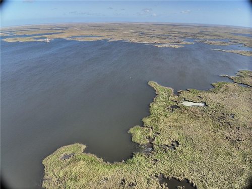
382 Acres of Marsh on Bayou la Loutre
The largest of four marsh tracts in St. Bernard Parish, at a little over $500 an acre.
 $25,000
15 photos
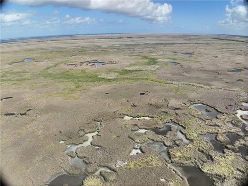
50 Acres of Marsh on Bayou la Loutre
Fifty acres of St. Bernard Parish marsh at a flat $500 an acre.
 $10,000
10 photos
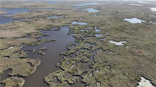
20 Acres of Marsh on Bayou la Loutre
The smallest and cheapest of the four, twenty acres at $500 an acre.
Questions about this parcel?
812-241-5653Ask about terms, request the documents on file, or arrange to walk the property.